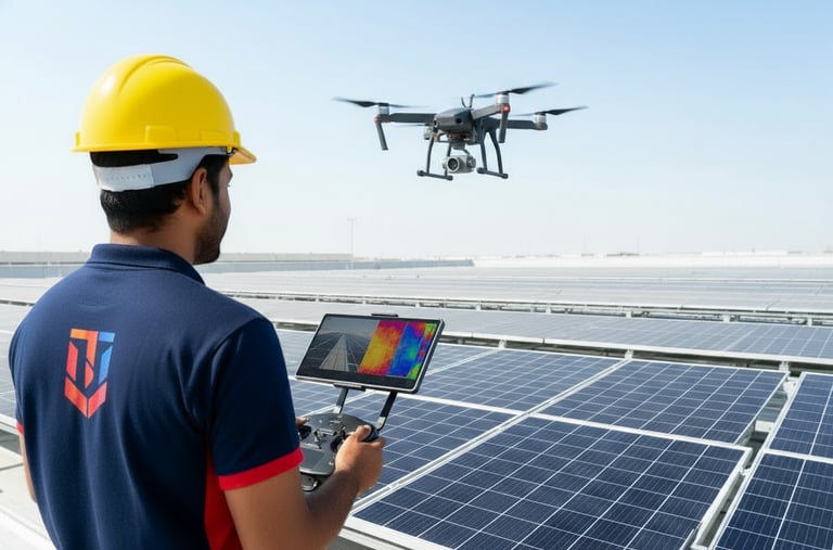
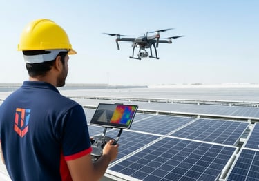
DRONE THERMAL ANALYSIS
Advanced aerial thermal inspections to detect faults, hotspots, and inefficiencies in solar panels — ensuring maximum performance and reliability.
Drone-Based Solar Inspection
Our advanced thermal drones detect real-time solar faults like hot spots and string failures with precision.
We help identify defective modules quickly, minimizing power loss and maintenance cost.
Every inspection is geo-tagged for easy reporting and accuracy.
Ensuring maximum plant efficiency through aerial innovation.
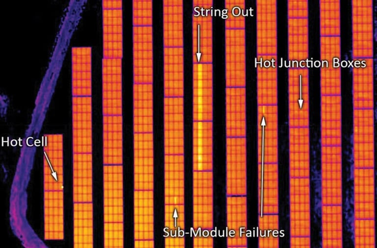
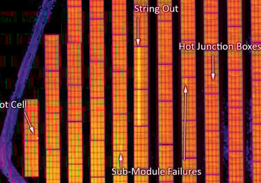
Thermal Analysis & Fault Detection
Using high-resolution thermal cameras, we capture panel temperatures with pinpoint clarity.
Our analysis detects microcracks, hot junctions, and sub-module faults invisible to the naked eye.
This data-driven approach prevents energy loss and supports predictive maintenance.
Reliable, efficient, and essential for solar plant performance.
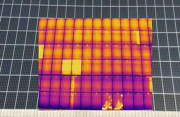
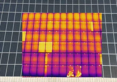
Solar Plant Health Monitoring
We perform periodic drone-based health checks across the solar field.
Thermal and RGB data are combined to visualize energy loss and degradation patterns.
Quick diagnosis ensures reduced downtime and extended panel life.
A smart way to keep your solar investment healthy and productive.
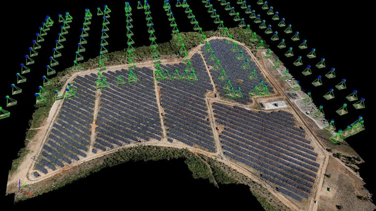
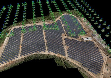
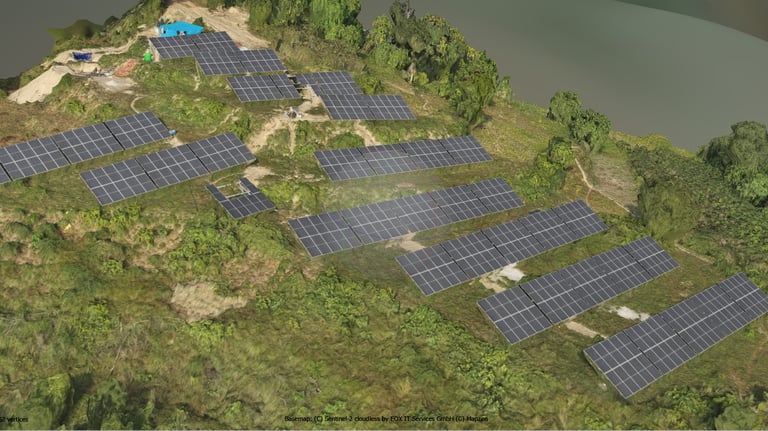
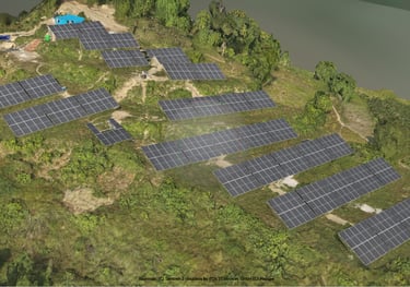
Drone Survey & Mapping
Our drones capture detailed topographic data with centimeter-level precision.
We generate orthomosaics, DEMs, and 3D terrain models for solar site design and analysis.
This data helps in slope study, layout optimization, and shading analysis.
Accurate aerial mapping for faster, safer, and smarter project planning.
Hill & Terrain Solar Survey
Specialized drone mapping for hilly and uneven landscapes.
We use RTK-enabled drones to measure slope, contour, and elevation variations accurately.
This enables engineers to plan stable and optimized solar structures in mountains.
Perfect for Uttarakhand’s complex terrains and remote project sites.
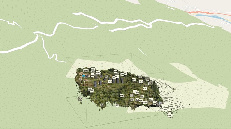
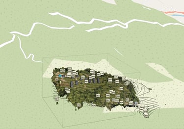
3D Modeling & Site Visualization
We convert drone survey data into high-quality 3D visual models.
These models help clients visualize solar layouts before construction.
Integrated with real terrain details for design precision and clarity.
Transforming raw drone data into actionable, realistic site plans.